Now Reading: Geographical Monuments in Andhra Pradesh that you can visit from Vizag
-
01
Geographical Monuments in Andhra Pradesh that you can visit from Vizag
Geographical Monuments in Andhra Pradesh that you can visit from Vizag
The state of Andhra Pradesh is known to be one of the most historically significant regions in India. But beyond its ancient temples, forts, and cultural landmarks, there are places whose history doesn’t just span centuries or millennia, it stretches back over a billion years. These geographical monuments reveal the story of Earth itself. Check out a few geographical monuments in Andhra Pradesh you can explore from Vizag.
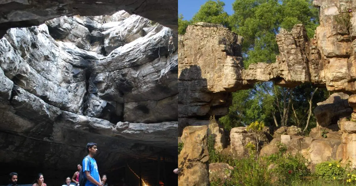
1. Belum Caves (Kolimigundla)
Distance from Vizag: ~660 km
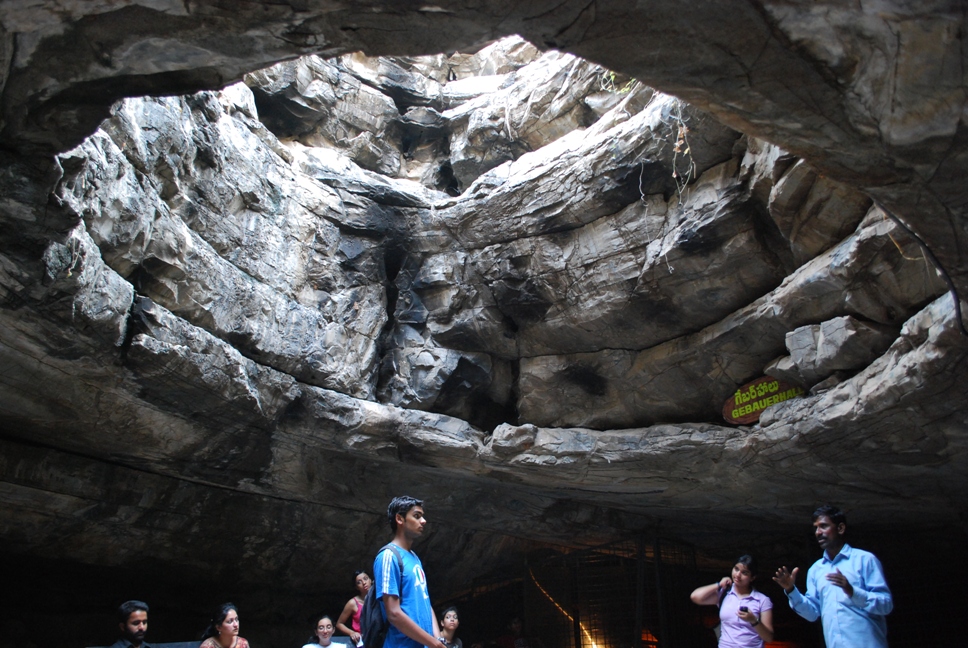
Belum Caves – Kolimigundla
Belum Caves, located in Kurnool district, were recently declared a National Geological Monument. These are the second-longest caves in India, stretching over 3.5 kilometres. Formed by the continuous flow of underground water, the caves feature long passages, spacious chambers, and freshwater galleries. This is a significant example of karst topography, offering insights into underground water flow, mineral formation, and the evolution of subterranean landscapes.
2. Eparchaean Unconformity (Tirupati)
Distance from Vizag: ~750 km

Eparchaean Unconformity – Tirupati
Near Tirupati lies one of India’s most important geological sites, the Eparchaean Unconformity. It represents a missing chapter of nearly 1 billion years in the geological record. It’s a visible boundary where 1.6-billion-year-old rocks rest directly on 2.1-billion-year-old rocks. This rare age gap between the two layers makes it one of the most unique geological monuments in the country and is crucial in understanding the tectonic history of peninsular India.
3. Natural Geological Arch (Tirupati)
Distance from Vizag: ~750 km
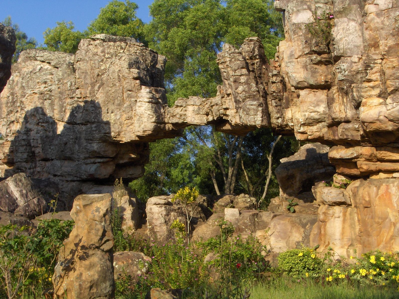
Tirumala Natural Geological Arch
Located near the Eparchaean Unconformity in Tirumala hills, this natural rock arch is one of the very few such formations in India. Shaped over 2.5 million years due to natural erosion by wind and water, the arch stands as evidence of how long-term weathering and natural sculpting shaped the Tirumala hills and reflect the geological evolution of the region.
4. Volcanogenic Bedded Barytes (Mangampeta)
Distance from Vizag: ~600 km

Panoramic view of the Mangampeta baryte mines
Located in Kadapa, Mangampeta is home to the largest known deposit of Volcanogenic Bedded Barytes in the world. This mineral is mainly used to increase the thickness of drilling fluids in oil and gas extraction. Formed around 16 million years ago through ancient underwater volcanic activity followed by sedimentation, this site helps in understanding how volcanic processes and sedimentation worked together in shallow marine basins.
5. Borra Caves and Erra Matti Dibbalu – Geological Landmarks Near Vizag
Borra Caves
Distance from Vizag: ~90 km
Located in the Alluri Sitarama Raju (ASR) district, Borra Caves are one of India’s largest and oldest limestone cave systems. Formed over a million years ago, the caves were shaped by the continuous flow of the Gosthani River through limestone, resulting in stunning karst formations typical of the Eastern Ghats.
Erra Matti Dibbalu (Red Sand Hills)
Distance from Vizag city centre: ~20 km
On Vizag’s own coastline stands Erra Matti Dibbalu, also known as the Red Sand Dunes. This rare geological formation is made of reddish sandy clay shaped by natural erosion, wind, and climatic changes over thousands of years. Recognised as a National Geo-heritage Monument, it is a key site for studying coastal evolution, ancient climate patterns, and sedimentary processes on India’s east coast.
These geographical monuments in Andhra Pradesh are not just landscapes but living records of Earth’s deep past. From billion-year-old rock boundaries to vast underground cave systems. Each site stands as timeless evidence of Earth’s dynamic history, preserved in stone for generations to witness and study.
Stay tuned to Yo! Vizag website and Instagram for more interesting updates.